 For the last few months I have been putting together a public exhibition with my colleague Chris Perkins. The exhibition is entitled Mapping Manchester: Cartographic Stories of the City and it is due to open on the 25th June 2009. The promo poster image is shown above.
The aim of exhibition is to reveal some of the ways in which mapping is ingrained into urban life. It seeks to demonstrates how maps work and change over time in response to technology, society and economic imperatives, highlighting visually striking cartographic representations of Manchester. It showcases the wealth of cartographic ‘treasures’ held by the University of Manchester and other institutions in the city, including generous loans of materials from the Manchester City Library and Archives and Chetham’s Library. The maps exhibited are more than just ‘pretty pictures’: they are powerful tools instrumental in the making of the contemporary Manchester, and can be read as rich stories of urban life.
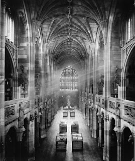
The exhibition is being held in the Reading Room of the John Rylands Library on Deansgate in the central Manchester.
 Cyber Badger Research Blog


0 Comments:
Post a Comment
<< Home